

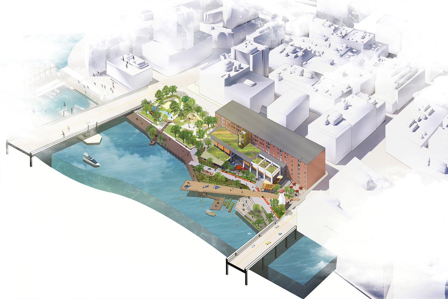
In 2019, the Museum announced an ambitious resilience planning initiative to respond to the acute flooding risk posed by sea level rise and extreme weather events affecting the Seaport and Fort Point area. Built on filled land, the entire Fort Point area is one of the lowest lying areas in South Boston. The Fort Point Channel is a flood corridor into the Seaport and South Boston, and extreme weather events therefore pose a direct threat to the Museum’s location on Fort Point Channel. To address this threat, and with external funding, the Museum selected international design firm Sasaki Associates to create a plan that would address both the need to protect the Museum as well as reimagine the Harborwalk area in front of the Museum to fully activate diverse uses and allow increased accessibility to the natural environment.
Building on the initial Sasaki design work, the Museum has continued to make progress on this initiative. Notably, in 2022 the Museum secured $1.058M in seed funding for project capacity building and feasibility planning. This funding will allow the Museum to refine design and engineering plans, secure necessary permits, hire project staff, and investigate and secure additional funding sources. The Museum also created a Board task force to provide oversight and leadership of the project. The Museum’s early steps to address vulnerability and resiliency of Fort Point Channel, the harbor, and Seaport have put it at the vanguard of burgeoning mitigation efforts. The Museum’s bold vision confronts the challenge of harmonizing the built and natural environments that come together on the Boston waterfront, ensuring that our beautiful Harbor is accessible to all for years to come.